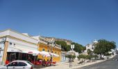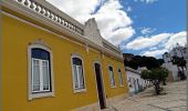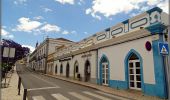

Do Passado ao Presente
SityTrail - itinéraires balisés pédestres
Tous les sentiers balisés d’Europe GUIDE+

Longueur
3,8 km

Altitude max
32 m

Dénivelé positif
51 m

Km-Effort
4,5 km

Altitude min
2 m

Dénivelé négatif
53 m
Boucle
Oui
Balise
Date de création :
2022-02-14 15:52:38.36
Dernière modification :
2022-02-14 15:52:38.36
1h00
Difficulté : Facile

Application GPS de randonnée GRATUITE
À propos
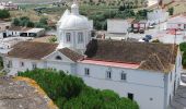
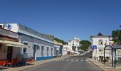
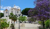
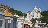
Randonnée A pied de 3,8 km à découvrir à Algarve, Faro, Castro Marim. Cette randonnée est proposée par SityTrail - itinéraires balisés pédestres.
Description
Randonnée créée par Câmara Municipal de Castro Marim / Odiana.
Sem marcação
Localisation
Pays :
Portugal
Région :
Algarve
Département/Province :
Faro
Commune :
Castro Marim
Localité :
Unknown
Départ:(Dec)
Départ:(UTM)
638117 ; 4120132 (29S) N.
Commentaires
Randonnées à proximité
Percurso da Mata


A pied
Facile
Vila Real de Santo António,
Algarve,
Faro,
Portugal

6 km | 6,6 km-effort
1h 29min
Oui
Percurso da Praia


A pied
Facile
Vila Real de Santo António,
Algarve,
Faro,
Portugal

12 km | 12,8 km-effort
2h 54min
Oui
Cerro do Bufo


A pied
Facile
Castro Marim,
Algarve,
Faro,
Portugal

5,8 km | 6,1 km-effort
1h 22min
Non
Sapal de Venta Moinhos


A pied
Facile
Castro Marim,
Algarve,
Faro,
Portugal

4,3 km | 4,6 km-effort
1h 3min
Non

Etape 10 AYAMONTE HUELVA


Vélo
Très facile
Ayamonte,
Andalousie,
Huelva,
Espagne

54 km | 60 km-effort
5h 0min
Non

w-portugal-rondwandeling-reservo-natural-do-sapal-de-castro-marim


Marche
Très facile
Castro Marim,
Algarve,
Faro,
Portugal

10,9 km | 11,6 km-effort
Inconnu
Oui

Eurovelo 1 Portugal - Vila Real Santo António / Tavira


Vélo électrique
Très facile
Vila Real de Santo António,
Algarve,
Faro,
Portugal

30 km | 33 km-effort
Inconnu
Non

Voilà Réal Safari


4x4
Très facile
Vila Real de Santo António,
Algarve,
Faro,
Portugal

46 km | 56 km-effort
3h 30min
Non


 SityTrail


